VISION
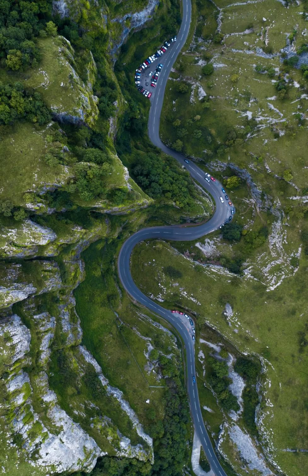
VISUALIZING WIND
CONDITIONS FOR
SAFETY IN THE SKY
Metro Weather, a Kyoto-based startup company, is taking a vital role in the development of the last mile “infrastructure of the skies” for an emerging “Advanced Air Mobility (AAM)/ Urban Air Mobility (UAM) society” where drones are expected to play active roles. We help achieving the development of infrastructures necessary for the safety of air mobilities including drones by not only observing and visualizing urban wind conditions (i.e., an infrastructure for air mobilities) in real time but also forecasting them with our compact Doppler lidar “Wind Guardian” and our wind forecast system called “Wind Foresight”. Furthermore, as our product and technology are also available for forecasting torrential rains and gusts that has caused ever-greater damages in recent years, Metro Weather is expected to contribute to the area of disaster prevention as well.
CORE TECHNOLOGY
Remote sensing
technology and
signal processing
technology
WindFore
Metro Weather’s core technology is the "Sky Scan" technology that “extract signals from noisy information” which we have cultivated over thirty years of large radar research at Kyoto University. It allowed us to use less expensive and low-powered components, and thus to achieve miniaturization of a lidar while maintaining its high performance (possible to measure up to twice the distance as where a device can accurately measure).
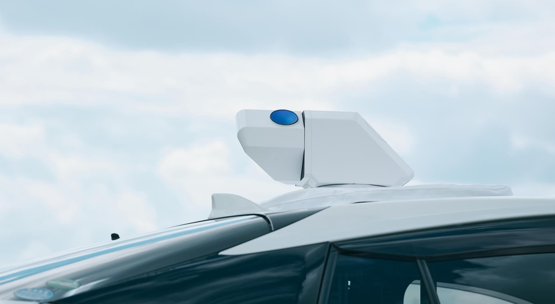
OUR PRODUCT
Wind Guardian
DOPPLER LIDAR
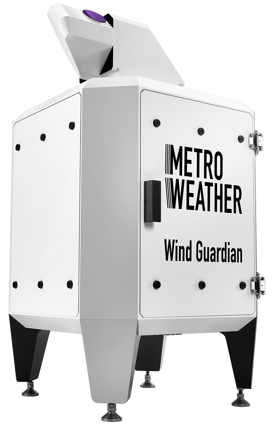
The ultimate Doppler lidar
A future of safer,
more reassuring skies
is close at hand.
Our compact Doppler lidar, Wind Guardian, is capable of visualizing wind conditions over cities (the “infrastructure of the skies”) in real time, enabling us not only to observe current wind conditions but to forecast future changes, thus ensuring safety in the infrastructure that is required for making the use of drones and other aspects of “air mobility” a reality.
OUR SYSTEM
Wind Foresight
Multi-Scale Wind Forecast System (MWFS)
Our wide-ranging and high-resolution wind forecasting system provides real-time forecasting of wind conditions, from several minutes ahead to several days ahead
Wind Foresight provides highly accurate wind condition forecasting data in real time, based on high-resolution weather forecasting simulations taking their default values from the three-dimensional wind measurement results obtained from Doppler lidar observation networks.
This system creates more accurate forecasts of the sky environment using our proprietary sensing technology signal processing technology, created over 30 years of research. It supports the creation of a safe and reassuring infrastructure environment.
*Alpha version service starts in June 2022
MARKET

Creating a
new world together!
NEWS
-
2026.01.27NEWS RELEASE
Announcement of Tokyo Headquarters Relocation
-
2026.01.20UPDATES
【Exhibition Information】「106th AMS Annual Meeting」on January 26th(Mon)- 29(Thu)
-
2025.12.25UPDATES
Notice of Year-End and New Year Holidays Closure
-
2025.09.22NEWS RELEASE
【Report】Real-Time Wind Observation Data Distribution Debuts in Japanese Sailing Competitions — Supporting the National Training Center with “Sports × Technology” to Advance Sailing —
-
2025.08.27UPDATES
【Exhibition Information】「AAM ASIA 2025」on Sep.16(Tue)-Sep.18(Thu)
-
2025.08.05UPDATES
Notice of Summer Holiday Closure
-
2025.08.04UPDATES
【Event Report】Summer Holiday Manufacturing Festival at the Uji Industrial Promotion Center
-
2025.07.29NEWS RELEASE
Metro Weather Raises ¥850 Million in Pre-Series B Round
-
2025.07.18NEWS RELEASE
TOKYO KEIKI and Metro Weather Announce Capital and Business Alliance 〜Accelerating Development and Production of Doppler LiDAR for Defense Applications〜
-
2025.07.17NEWS RELEASE
【Japan’s First】Collaboration with Wakayama Sailing Center for in July and August 2025 Announcement of “Real-Time Wind Observation Data Distribution for Three Domestic Sailing Competitions” — Contributing to Sailing Sports Through the Power of Technology —